
OpenJUMP
Visualize and customize GIS data layers
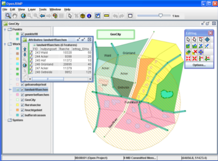
Description
OpenJUMP serves as an efficient GIS data viewer for visualizing and customizing spatial information. Users can create projects with multiple layers and categories, editing geometry and attribute data in formats like shapefiles and GML. Adjust settings to tailor the interface and tools to specific tasks. This capability makes it excellent for managing, analyzing, and presenting geospatial data in a user-friendly environment.
Screenshots
Click to view full size